


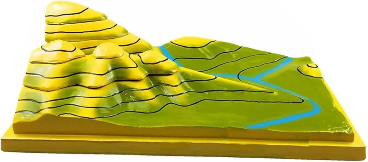
- Contour topographic map uses a three-dimensional layered and vertical method to express various terrains according to the contour terrain call
- Teaching Instruments select the original content: mountain tops, ridges, valleys, saddles, steep cliffs, rivers, alluvial fans, gentle slopes, and steep slopes
- The main part of the model can be disassembled in layers along the contour line, and the surface and the layered section are drawn with corresponding isotropic lines
- Wildely used in for crustal geography geology education or landform, Can help you to learn accurately and effectively
- Made from premium PVC material, this model is lightweight, anti-corrosion and durable
This product has an electronic invoice
Feature:
Description:
According to the contour terrain, this product uses a three-dimensional layered and vertical method to represent various terrains
The content of the selection includes: mountain tops, ridges, valleys, saddles, steep cliffs, rivers, alluvial fans, gentle slopes, and steep slopes
Model main body Some parts can be dismantled in layers along the contour lines, and corresponding isotropic lines are drawn on the surface and the layered section
Specification:
Product Name: Contour Terrain Model
Material: PVC
Process: manual grouting, polishing and coloring
Scope of application: teaching, decoration, demonstration, olcanic Geomorphic Model-for communication
Products Include:
1 Contour Terrain Model
NOTE !!!
--1-2 cm measurement error is a reasonable range, due to the manual measurement methods
--Please be reminded that due to lighting effects, monitor's brightness / contrast settings etc, there may be a little difference in the color of the pictures and the actual item


